
Rangewide habitat status assessment
Several recovery objectives within the Updated Goals and Objectives for the conservation of Lahontan cutthroat trout (LCT) require riparian habitats to function ecologically. However, accurately assessing the status and trend of habitats important to fulfilling these recovery objectives across the historical range of LCT has been challenging due to the large spatial scale, high degree of habitat variability and complexity, and limited resources of the recovery partners. Even more challenging is using the data we have to inform strategic management decisions on the ground (e.g., prioritizing restoration, shifting management activities, and focusing monitoring efforts) due to similar factors.
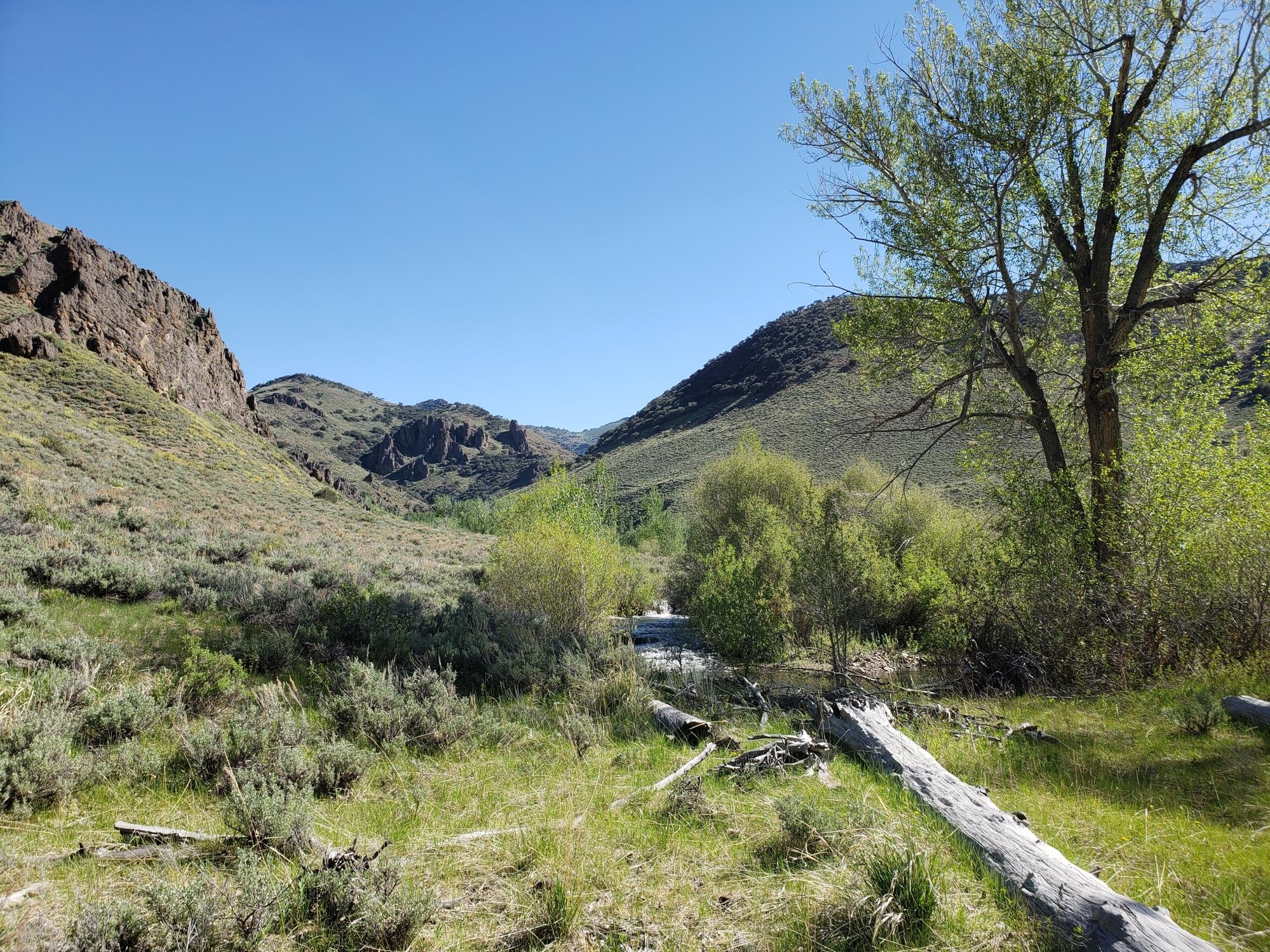
Riparian habitats have been monitored for decades using a variety of reach-based, quantitative protocols (e.g., MIM, GAWS) that measure both riparian and instream variables, but efforts to compile, centralize, and apply these data to help inform management decisions consistently across the range of LCT has proved challenging.

Data informs management:
“Riparian habitats have been monitored for decades using a variety of reach-based, quantitative protocols (e.g., MIM, GAWS) that measure both riparian and instream variables, but efforts to compile, centralize, and apply these data to help inform management decisions consistently across the range of LCT has proved challenging.”
Monitoring has occurred on public and private lands across much of the historical range of LCT. Basin-level monitoring has been undertaken for meta-populations and at other scales, including entire Bureau of Land Management districts. Proper Functioning Condition (PFC) assessments have been applied at sites across the historical range of LCT as well. However, PFC assessments are not always done in combination with quantitative data collection, limiting the ability to assess the status and track habitat changes through time. With additional planning, this could be done in an efficient and effective way. However, we currently lack an inter-agency program to assess the condition and trend of riparian and instream habitats within the potential range of LCT.

Goal:
“Develop a program that assesses the status of riparian and instream habitats across the range of LCT, with a focus on habitats that are likely to remain suitable for trout into the foreseeable future.”
The lack of a centralized database and the use of different monitoring methods to answer similar, but often agency-specific questions, makes it difficult to discern habitat trends across the range of LCT. Accordingly, we lack the capacity to tell a coherent story across the range of LCT. We aim to resolve this limitation over the next several years by using existing quantitative and qualitative data as well as new landscape-scale approaches to increase our understanding of riparian and instream habitats. This information can then be used to prioritize future monitoring and inform management actions.
The overarching goal of this multi-year effort is to develop a program that assesses the status of riparian and instream habitats across the range of LCT, with a focus on habitats that are likely to remain suitable for trout into the foreseeable future. Remote sensing approaches have become more robust and available and potentially allow us to assess the condition and trend of all existing LCT habitats simultaneously. This approach seeks to provide an objective, repeatable, and standardized dataset for all existing LCT habitats affordably and rapidly. We will coordinate the use of several remote-sensing tools (see 2020 approach outline below) from various research groups to the potential habitats across the historical range of LCT. It is our hope that we can use these remote sensing datasets in combination with existing habitat data (i.e., PFC, GAWS, MIM, AIM) to inform where to prioritize restoration efforts and management actions that would provide the highest cost/benefit ratio in the near future. In order to get from where we are now to accomplishing our overarching goal, we will first need to complete the near-term goals and objectives described below.
2020 Goals and Objectives. We will contract Utah State University and the Desert Research Institute to apply GIS-based, remote sensing tools to the historical range of LCT, focusing on currently suitable habitat (i.e., current cold-water habitat that is likely to support trout). In addition, recovery partners will work together to centralize and analyze existing data (e.g., PFC, GAWS, MIM, AIM) within three focal areas to explore opportunities to crosswalk the landscape-scale GIS results with reach-based field measurements in order to improve strategic placement of recovery/restoration actions.
Implement and ground truth a landscape-scale remote sensing assessment within the historical range of LCT;
Provide a consistent rangewide assessment of riparian condition (hydrologic, vegetation, and geomorphic); interface this with roads and other land uses, trend, and resilience; and
Ground-truth the remote sensing tools during the summer to improve and determine their limitations;
Centralize and analyze all appropriate existing qualitative and quantitative data (variable scales, from watershed to reach) within the three focal areas.
Are the remote sensing tools and strategies described above generally useful, or do different objectives and monitored metrics in different places require new remote sensing or on-the-ground data? Also, are there specific geomorphic settings where this linkage is stronger or weaker? The goal here is not to validate any specific method, but more to help understand the meaning if there is disagreement from different data sources.
Where existing data are not available, it may be necessary to focus field efforts in these areas to allow for greater inference (e.g., performing reach delineation and description of potential, PFC assessment, assessment of LCT habitat potentials and needs, identification of local priorities, management strategies and objectives, and collection and interpretation of quantitative monitoring data).
Literature cited
Evans, Carol and Devon Snyder. 2012 Maggie Creek Watershed Restoration Project, 1993 South Operations Area Project Mitigation Plan, 2011 Monitoring Summary and Evaluation of Biological Standards Elko District, Bureau of Land Management March 28th, 20 pp.
Evans, Carol 2017. Summary of Available Information for Major Streams (Lotic Riparian Areas) Elko District, Bureau of Land Management, June 12th, 20 pp.
Kozlowski, Don, Robert K. Hall, Sherman Swanson, and Daniel T. Heggem. 2016. Linking Management and Riparian Physical Functions to Water Quality and Aquatic Habitat. Journal of Water Resource and Protection. 8(8):797-815. DOI: 10.4236/jwarp.2016.88065 http://file.scirp.org/Html/4-9402789_67855.htm
Macfarlane, William W. Jordan T. Gilbert, Joshua D. Gilbert, William C. Saunders, Nate Hough-Snee, Chalese Hafen, Joseph M. Wheaton,and Stephen N. Bennett. 2018. What are the Conditions of Riparian Ecosystems? Identifying Impaired Floodplain Ecosystems across the Western U.S. Using the Riparian Condition Assessment (RCA) Tool. Environmental Management https://doi.org/10.1007/s00267-018-1061-2
Macfarlane, William W. Jordan T. Gilbert, Martha Jensen, Joshua D. Gilbert, Nate Hough-Snee, Peter A. Hugh, Joseph M. Wheaton, and Stephen N. Bennett. 2016. Riparian vegetation as an indicator of riparian condition :Detecting departures from historic condition across the North American West Journal of Environmental Management xxx1-14 www.elsevier.com/locate/jenvman
McGwire, Kenneth C. (Desert Research Institute). 2019. Optimized Stratification for Mapping Riparian Vegetation in Arid and Semiarid Environments, Remote Sensing. 14 pp.
Newman, Sarah and Sherman Swanson. 2007. A Comparison of Riparian Assessments for the Marys River Basin, Nevada. J. of the Am. Water Res. Assoc. 44(1):1-13 DOI: 10.1111/j.1752-1688.2007.00134.x http://onlinelibrary.wiley.com/doi/10.1111/j.1752-1688.2007.00134.x/epdf
Open Range Consulting. 2015. Long Term Assessment of the Squaw Valley Allotment’s Riparian Areas 2014 Watershed Remote Sensing Project (Squaw Valley Allotment) for Elko District, Bureau of Land Management. 40 pp.
2023 Habitat Program Annual Report
Pending publication (2024)